
Looking for some awesome snowshoe or cross-country skiing trails in the Winter Park / Fraser area? I highly recommend an amazing little network of trails we discovered off Vasquez Road that is used for mountain biking in the summer. They are a charming little spiderweb of trails that don’t have a high volume of traffic (I’m almost hesitant to write about this area less it get too popular) but are positively perfect for getting your winter outdoor activity on!
In February, we had a wonderful weekend stay in Winter Park, CO. As you may have seen on my Instagram post, we were originally going to try to snowshoe Jim Creek Trail, which was recommended to me by my friend Lan, but when we drove up to the trailhead it was blocked off with a gate and do not enter sign from the National Forest. Wahh!
RELATED: Updated list of Great Snowshoeing Trails Near Denver
We knew that places like the YMCA of the Rockies (which we had a great time at last year) and Devil’s Thumb Ranch were in the area and had snowshoe trails, now that we are more familiar with snowshoeing and have our own gear, the thought of paying a $20/person day fee at either of those places was not that appealing to us. After all, one of the great things about Colorado is all the amazing outdoor activities you can do for FREE on public land!
With our original plan thwarted, we drove back into town and stopped by the Winter Park Trading Company and asked for a recommendation of a place to snowshoe. The guy at the desk told us to just drive to the corner, make a right onto Vasquez Road and keep driving until we reached the end where we’d see a bunch of trails. Seeing as how it was so close, we decided to give it a try.
So glad we did! Once Vasquez Road turned into County Road 7, we drove a little bit and to our left, we saw the trailhead for Blue Sky, but we kept on going. A little further way down on our right we saw a big turnout and a sign for D4, WTB, D3, and Vasquez Road. Since the guy at WP Trading Co told us to drive to the end, we kept going. Less than a minute past the turnout we came to a large gate marking the end of the road and saw a number of cars parked at the dead end.
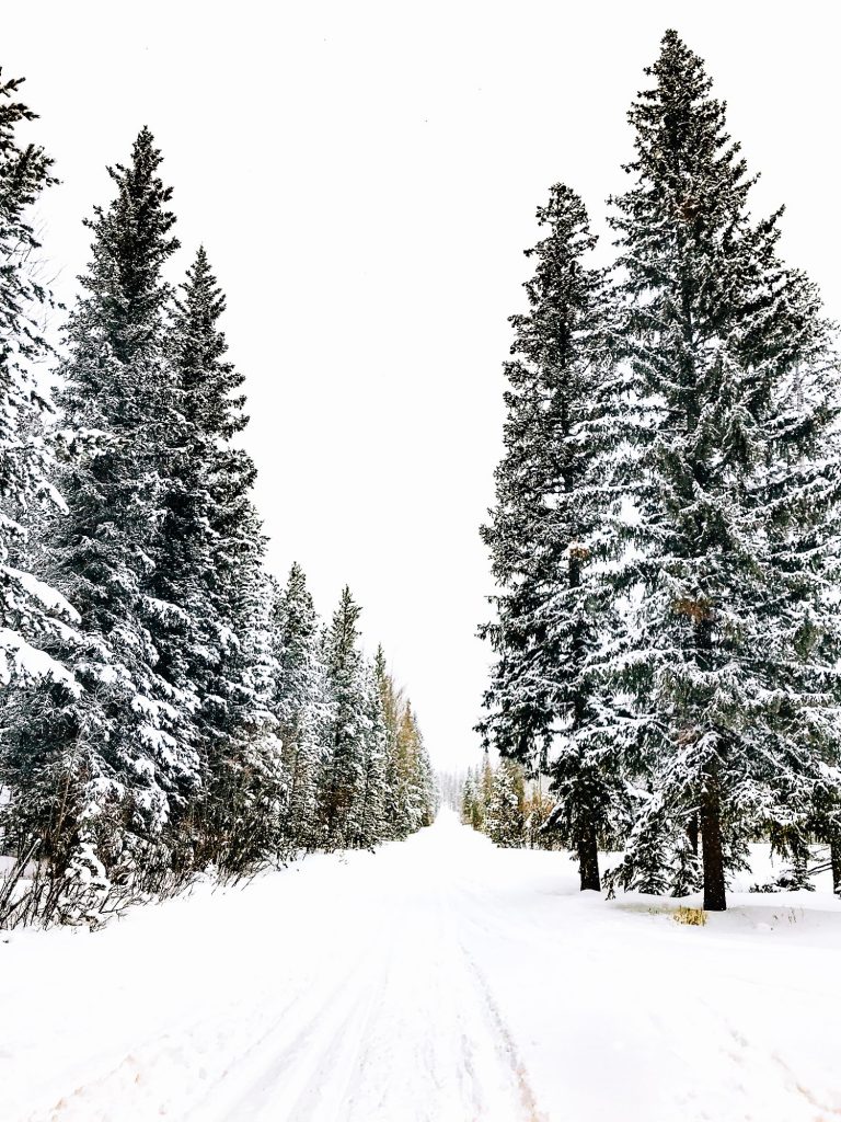
Since we hadn’t planned on coming out these ways, we didn’t have maps and there weren’t any in the area. To play it on the safe side, we just headed past the gate and up the rest of County Road 7. Right before reaching the intersection where the County Road 7 splits off in a number of directions we came across a trail sign off to the right. We could see there was a trail, but it looked like no one had been on it in a very long time – fresh powder! We decided to give it a try because being up in the trees is always a lot more fun than just walking along a road.
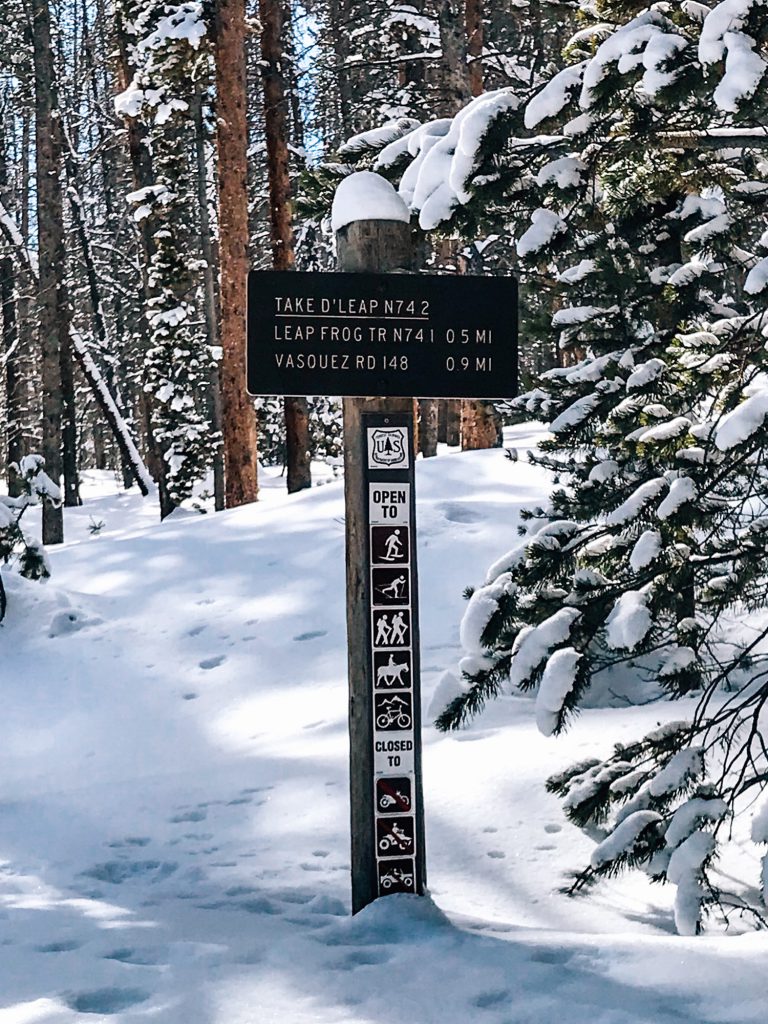
Unfortunately, I’m not sure what trail this was that we took – I didn’t take a photo of the trail marker and when we tried to find the trail online afterward we weren’t able to find it. Based on our GPS tracker, it wasn’t the Ho Chi Min Trail, however, it did eventually connect with the Take D’ Leap trail so it may have been an alternate beginning of Leap Frog trail.
We took the Take D’ Leap trail a bit of ways before turning back and then decided to take a shortcut back to the road by taking a trail that brought us back onto D4, and eventually back to Take D’ Leap leading to a large turnout area.
Our second day in the area we decided to park in a turnout area that was right next to the Take D’ Leap, which would lead us back to the D4 trail.
We headed up D4 and then came to trail markers on either side of the trail. The first one on the right a trail marking for D4/D3, the next one on the left for Take D’Leap/Leap Frog. Since we wanted to keep on D4, we kept going to the left.
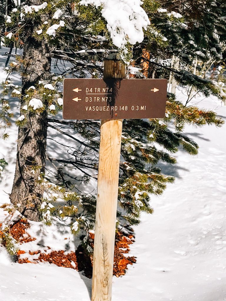
Shortly after, we got to another intersection with trail markers on either side of the trail. We wanted to switch to D3, so we could start looping around, so we took the right to go along the trail marked with D3 and D4.

At a certain point, we got to the next marker we were looking for – where we connected with Leap Frog.
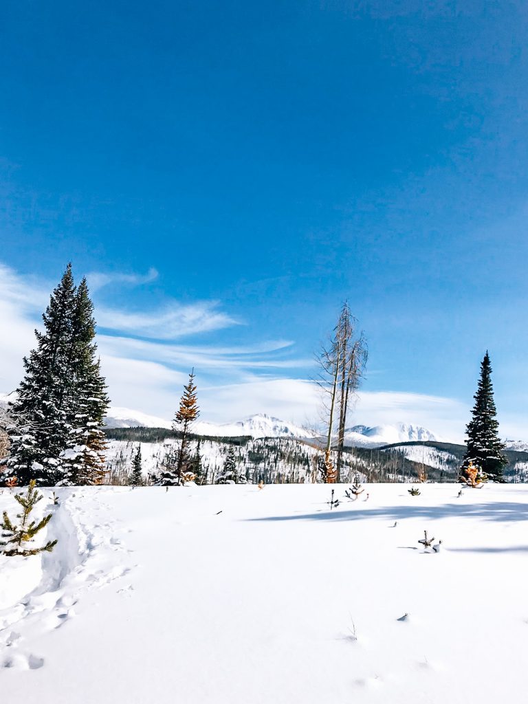
After a lot of walking through the trees, we came to a section above treeline where we could get sweeping views of the mountains. So beautiful and no one around!

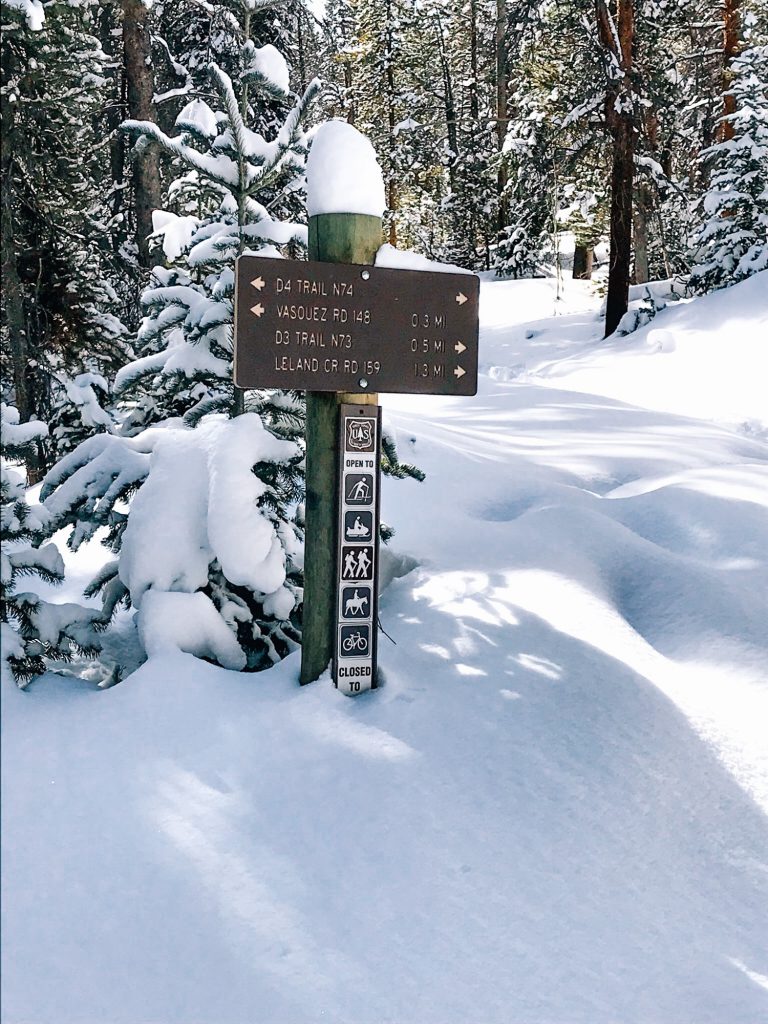
We continued following the trail, finally coming to our last major mile marker which noted that if we went straight we would be starting the Sunset Pink trail. However, we wanted to loop back to our car so we went right, continuing back down D3, and eventually coming back to the D4 connection back to our car.

This area is a bit confusing because we weren’t able to find very good trail maps of the area and once you get into the forest there seems to be a myriad of smaller connecting trails that aren’t on the maps.
But with so many little trails to explore we ended up having to trail blaze along some parts, getting some of that fresh powder. We had a great time!⠀
What about y’all? Have you ever been snowshoeing before? If so, what are some of your favorite places to go during the winter?
Looking for more spots? Check out my updated list of Great Snowshoeing Trails Near Denver.